In India, it took more than half a century to come up with a comprehensive disaster management Act, that is the National Disaster Management Act of 2005. It was the first exclusive plan aiming at disaster preparedness and mitigation which was influenced by the United Nation’s declaration of the International Decade for Natural Disaster Reduction (IDNDR). On the other hand, the National Action Plan on Climate Change (NAPCC) paved the road for the climate regulation act in the country. The recent flash flood in the Rishiganga river in Uttarakhand reminds us about the fragility and the vulnerability of the mountain ecosystems and the need for a Disaster Management plan which takes into account developmental projects and their aggravating impact on disasters.
Out of the eight missions stated in the NAPCC, a special plan named National Mission for Sustaining Himalayan Ecosystem (NMSHE) is fully dedicated to the management and monitoring of mountain ecosystem of 13 states. A five-year plan for the project was dedicated to a budget of Rs. 550 crore which includes monitoring, the conduct of workshops and production of reports on site-specific studies. If we look at the major goals of this mission; those are mostly development-oriented such as land-use planning, sustainable agriculture, identifying best practices for infrastructure and sustainable tourism.
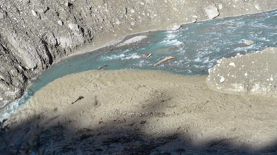
With the demolishing of the Rishiganga hydropower project, ‘temples of resurgent India’ are again at the centre of the debate and putting the concept of ‘sustainable development’ into a doubtful position. Dams are usually built to control the flow of water and expected to control the flood as well. However, recent experiences like the 2018 Kerala flood and the 2016 Bihar flood bears proof that dams are causing more devastation and acting as an agent in the progression of hazard and vulnerability. In this context, it is crucial to recognise Uttarakhand -the ‘water tower of India’ hosts several rivers and most of them are in their youth phase. The area also falls under zone of seismic activities, periglacial activities etc. Hence, a thorough investigation is required before moving ahead with the proposal of new hydropower projects, bridges, road construction and widening project like the ‘Char Dham’. We need to remember that development always comes with a cost to either human or the environment.
Natural hazards are typical events that are caused by a sudden or cumulative change in hydrological, geological and climatological factors. It is only when a large number of people and their losses comes into consideration, hazards transform into disasters. As a result, vulnerability assessment should become a major aspect of disaster-related policy initiative. With the recent changes made in the Environment Impact Assessment Act, such as the reduced role of public opinion and less complex steps for clearance of projects, our hope in this aspect seems very bleak. However, area-specific projects like NMSHE are encouraged with some modifications. We also need to acknowledge that stakeholder participation is crucial in both information generation and dissemination. It was reported in the recent flash flood that people stayed away from their home after hours of the flash flood occurrence. It is due to a lack of enough information about the geographical episodes occurring in their area of residence.
On the other hand, it is also necessary to respect the indigenous and local knowledge base of the people. It is the same place where India’s environmental Chipko movement started and civil organisations were already raising their concern about the hydropower projects. Integration of Traditional Ecological Knowledge with western scientific knowledge would be the first step towards acknowledging and respecting local needs. Besides, strengthening the early warning system would be a novel step to shift away from the regular disaster management approach, which generally focuses on the post-disaster management system.
Although it is very difficult to provide early warning for seismic hazards or flash floods, a beneficial path would be to identify hazard-prone zones with the help of advanced technologies like Geographic Information System (GIS), Remote Sensing etc. Hazard-zone mapping along with social vulnerability analysis can help to avoid future devastations. A comprehensive and inclusive policy is required which combines the wisdom from both STEM and social sciences. It is also crucial that we redefine the concept of ‘sustainable development’ altogether. There are ample examples of developmental projects turning into disasters (Chernobyl, Fukushima, Bhopal) in the past and hence we are in need of a special action plan for situations when developmental projects turn into disasters.
(The writer is a PhD Scholar in Development Studies from Bengaluru)