Cyclonic storm 'Helen' to cross AP coast tomorrow afternoon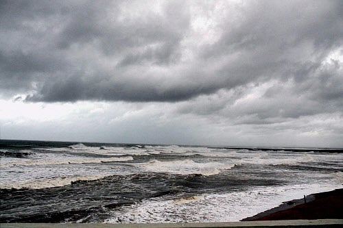
Last Updated IST
Coastal districts in southern Andhra Pradesh and northern Tamil Nadu are bracing for yet another cyclone fury, as a deep depression in the Bay of Bengal transformed into a full-blown storm dubbed "Helen," which is likely to make landfall at Kavali in Nellore district around Thursday night. PTI File Photo.
The severe cyclonic storm 'Helen' will cross the Andhra Pradesh coast tomorrow, and would bring very heavy rainfall under its influence, Indian Meteorological Department said today.
The severe cyclonic storm would move west-northwestwards slowly for some time, then west southwestwards and cross south Andhra Pradesh coast between Nellore and Machillipatnam, close to Ongole around afternoon of November 22, the IMD said.
IMD predicted heavy to very heavy rainfall at a few places over coastal Andhra Pradesh and isolated heavy to very heavy rainfall at Rayalaseema and adjoining north Tamil Nadu.
"Gale winds speed reaching 100-110 kmph gusting to 120 kmph would prevail along and off south Andhra Pradesh and north Tamil Nadu coasts," it said.
Squally winds with speeds reaching 55-65 kmph gusting to 75 kmph would prevail along and off north Andhra Pradesh, north Tamil Nadu and Puducherry.
Sea conditions would be very high along and off Andhra Pradesh coast, and rough to very rough in north Tamil Nadu and Puducherry coasts, it added.