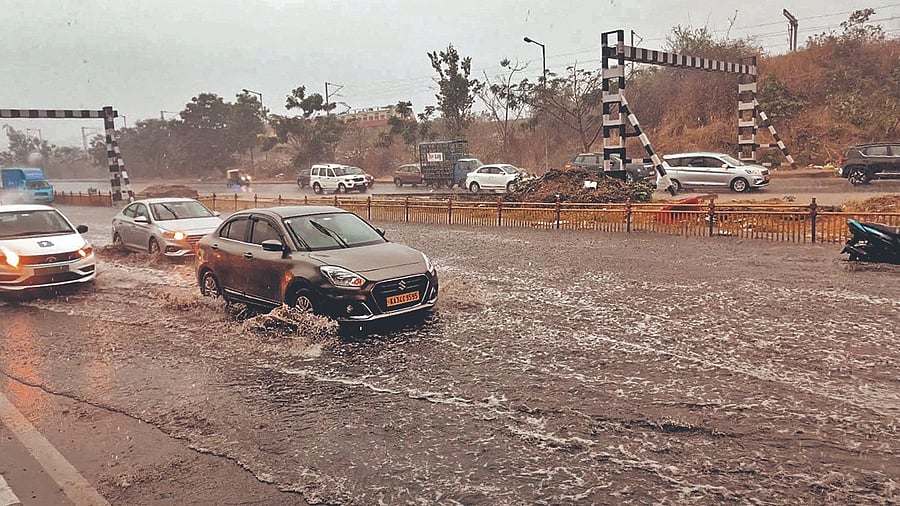
Image showing rains in Bengaluru, March 22, 2025.
Credit: DH Photo
Bengaluru: Sudden pre-monsoon showers brought much-needed relief from the scorching sun in Bengaluru on Saturday evening, bringing with it flooded roads, fallen trees and crawling traffic. Light to moderate rainfall was reported in different parts of the city, with the northern part of the city seeing considerable rainfall in a short span of time.
The India Meteorological Department recorded 3.6 mm of rainfall with thunderstorm in their Bengaluru City observatory. The Kempegowda International Airport IMD observatory recorded more than ten times this amount, with 38.6 mm rain until 5.30 pm.
Cool winds brought dark, looming clouds that enveloped Bengaluru, bringing consistent rain throughout the city all evening. While north and parts of east Bengaluru received the most amount of rain, central and south Bengaluru also saw light rainfall. By 7.15 pm, however, a more intense rainfall was reported in the southern part of the city, extending to Ramanagara.
According to the Karnataka State Natural Disaster Monitoring Centre (KSNDMC), Yelahanka recorded the highest amount of rainfall, with some parts recording over 45 mm of rain.
Additionally, a hailstorm was reported in Hoskote. The IMD forecasted light rainfall over isolated places over Raichur, Vijayapura, later on Saturday night.
However, these conditions in Bengaluru are likely to persist only until Sunday.
N Puviarasan, Scientist 'F' and Head of the Meteorological Centre explained that this sudden shower is because of wind discontinuity, land heating, and a north-south trough running from North interior Karnataka to south Tamil Nadu at 1.5 km above mean sea level. "This will continue until tomorrow (Sunday). After that, the trough is moving out, so we will not get any rain after that," he said.
The temperature in the city has also remained at least a degree less than the normal range of about 34.3° C. "There are strong winds now, which is why the temperature dips. The maximum temperatures have also not been very high in the last three to four days. A similar temperature range is forecasted for three more days, after which the maximum temperature will shoot up," Puviarasan added.