
The Command and Control centre being managed by the Tumakuru Smart City Limited (TSCL) is playing a major role in preventing the spread of COVID-19.
As of now, all the people in home quarantine have been geo-mapped; especially those who have travelled abroad and come back and those who have come in primary contact with those infected with the virus.
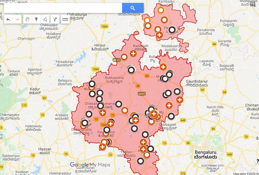
The details of the quarantined people have been formed into GIS layers to facilitate the management of a case that tests positive for the virus.
The geo-mapping is being done on the health condition and the number of days spent in quarantine. A colour code is being used to identify the case status.
Yellow is for 1-14 days of quarantine. Orange for 15-28 days. Brown is for end of quarantine. Blue is for unable to detect status. And red for those who test positive and are being treated in isolation. Green who those who test positive and recover.
Using the GIS, it is convenient to isolate the person who tests positive and contain the spread of the infection.
With this software, it is also convenient to determine the people who have come into primary contact with the Coronavirus positive person. The GIS covers both private and government hospitals across the district.
TSCL Managing Director T Bhoobalan said that the Command and Control center is playing a pivotal role in the monitoring and containment of COVID-19.