A screen grab from the video
Credit: ISRO/YouTube
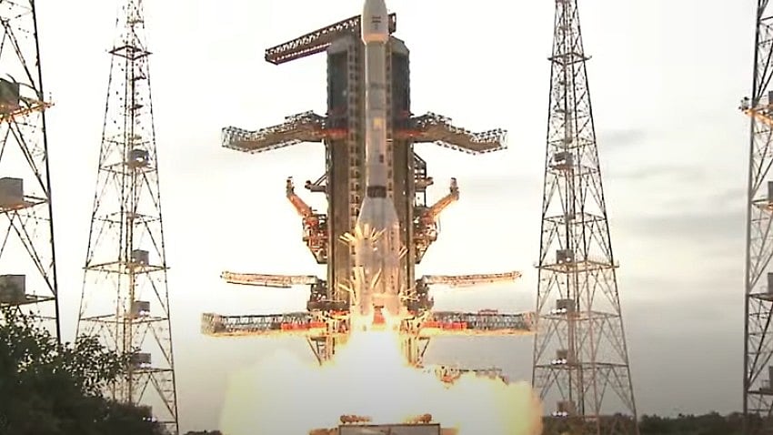
Sriharikota (AP): Billed as the costliest and most powerful earth monitoring satellite that will scan the entire globe every 12 days, the NISAR satellite, jointly built by the Indian Space Research Organisation (ISRO) and the US’ National Aeronautics and Space Administration (NASA), was on Wednesday successfully launched from the Satish Dhawan Space Centre (SDSC) here.
The launch, which took place from SDSC’s second launch pad at 5:40 pm, marks a significant chapter in Indo-US space ties – scientists from both countries have been working on the mission for over a decade.
Eighteen minutes after the successful lift-off, the GSLV-F16, which is the 18th flight of India’s Geosynchronous Satellite Launch Vehicle, injected the NISAR satellite into a 743-km sun-synchronous orbit. Nearly two hours later, NASA said mission controllers for NISAR had received full acquisition of signal from the spacecraft.
Built at an estimated cost of $1.5 billion with a mission life of 5 years, NISAR is probably the most expensive and powerful earth monitoring satellite, ushering in a new era in satellite technology and Earth monitoring.
NISAR will scan the entire globe every 12 days, providing high-resolution, all-weather, day-and-night data, and it can detect even subtle changes in Earth’s surface -- like ground deformation, ice sheet shifts, and vegetation dynamics. The mission’s objective is to study land and ice deformation, land ecosystems, and oceanic regions in the areas of common interest to the scientific communities of India and the US.
“The GSLV-F16 vehicle has successfully and precisely injected the NASA-ISRO Synthetic Aperture Radar (NISAR) satellite, weighing 2,393 kg, into its intended orbit,” Dr V Narayanan, Chairman, ISRO, declared at the Mission Control Room, sending scientists into raptures.
“All the vehicle systems were quite normal as expected and as predicted. The successful launch demonstrated international teamwork between two space agencies, ISRO and NASA. The data collection by NISAR will be useful for the scientific communities of the globe,” he added.
Narayanan said the potential applications from the satellite are huge, and the global scientific community is eagerly awaiting the satellite data for their respective research and usage. "The data generated from the mission is not going to be used by one or two countries. The entire globe is going to benefit from this great accomplishment," he added.
The 2025-2026 financial year is likely to be busy for ISRO, with the agency planning about nine satellite launches involving PSLV, GSLV, and LMLV, Narayanan announced.
Casey Swails, Deputy Associate Administrator at NASA, said the successful launch of the satellite is not only a major achievement for space science, but a powerful symbol of international cooperation.
“Insights from this mission will help us better understand the subtle movements on Earth’s surface and improve our predictions for the future. NISAR will give decision-makers the tools to monitor critical infrastructure; respond faster and smarter to natural disasters like earthquakes and floods; map farmland to improve crop output; and more,” she added.
The data collected from NISAR will enable informed decisions that benefit communities globally, Swails added.
NISAR will be the first satellite to collect radar data simultaneously in two microwave frequency bands -- L-band and S-band -- to measure changes on the planet’s surface, including movements as small as a centimetre. While the S-band was built by ISRO, NASA built the L-band.
This capability will allow the mission to observe a wide range of Earth processes, from glacier flow rates and ice sheet dynamics to earthquakes and volcanic activities, Narayanan said, adding that the mission will help produce high-resolution images and data on various aspects of the planet.
The launch follows just weeks after Indian Air Force Group Captain Shubhanshu Shukla’s successful return to Earth from the International Space Station (ISS) aboard SpaceX’s Dragon spacecraft -- a demonstration of the strong collaboration between India and the US in the space sector.
Weighing 2,392 kg, NISAR will observe Earth with a swath of 242 km and high spatial resolution, using SweepSAR technology for the first time. The mission will also support many critical applications including sea ice monitoring, ship detection, storm tracking, soil moisture changes, surface water mapping, and disaster response.
The radar penetrates clouds and darkness, enabling NISAR to collect data day and night, in any weather, and the instrument’s imaging swath -- the width of the data strip collected along the orbit track -- is greater than 150 miles (240 kilometers), which allows it to image the entire Earth every 12 days, the ISRO added.
As the mission continues over the years, the data collected will enhance scientists’ understanding of the causes and consequences of land surface changes, improving the ability to manage resources and prepare for, and cope with, global change.