
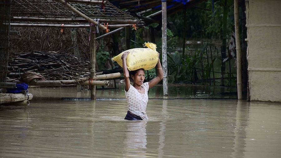
More than 5 lakh people have fled their homes in Assam to escape heavy floods triggered by pre-monsoon rains that drowned eight. Torrential rains lashed most of the rugged state, and the downpour continued on Wednesday, with more forecast over the next two days. Cachar was the worst-hit district in the state.
Water levels in the Brahmaputra were expected to rise further, national authorities said.
Meanwhile Union Home Minister Amit Shah discussed the overall flood situation in Assam with Chief Minister Himanta Biswa Sarma over phone and assured all possible help from the Centre.
Landslides wreaked havoc in Arunachal Pradesh and Meghalaya also snapping road connectivity in many areas.
The Higher Secondary first year (class 11) examinations in Assam starting from Wednesday have been suspended partially due to floods and extensive damage caused by heavy rains in the last few days.
In Arunachal Pradesh, landslides in several areas have blocked roads affecting vehicular traffic.
Roads from Itanagar to Gohpur in Assam and to Ziro in Lower Subansiri district via Potin were blocked due to mud slips.
Landslides were also reported from Karsingsa block point along the Itanagar-Banderdewa NH-415, Itanagar Gompa and RWD Colony here, officials said.
An official in Agartala said that the Tripura government is readying a contingency plan for supply of essential items by road from Assam as restoration of railway network affected by landslides in the neighbouring state will take at least two months.
Why does it flood every year?
The Brahmaputra basin is one of the biggest riverine systems in Asia, originating from Tibet flowing through India and Bangladesh and draining into the bay of Bengal. Owing to the rocky terrain and glacial origin, the river generates massive amounts of sediment. As the river flows to a relatively flat plain (Assam), its speed slows and the excess silt gets deposited on its banks.
Apart from this, more than 50 tributaries feed the river in addition to melting glaciers during summer months which is followed by heavy monsoons. As a result the river naturally overflows during this period.
According to Nayan Sharma, an adjunct professor at Indian Institute of Technology, Roorkee, deforestation has aggravated flood and erosion in Assam. “The Brahmaputra basin receives an average annual rainfall of about 1500 mm, whereas the rainfall is barely 400 mm in the Tibet region. Thus, the bulk of the flood flows are generated within the watershed areas of India, while the Yarlung Tsangpo mainly conveys the snowmelt streamflow mostly from the Himalayan glaciers,” Sharma said.
Several man-made factors have also aggravated the flooding problem. Embankments, encroachments and deforestation have all contributed to the problem.
The silt from high-altitude areas is deposited, forming sand banks and islands. Over the years, people have settled in these areas which have obstructed the river’s path.
People in Arunachal Pradesh and Assam allege that flood has aggravated in the region as China has constructed several big dams in the upper reaches of the Brahmaputra, which is known as the Yarlung Tsangpo there.
(With agency inputs)