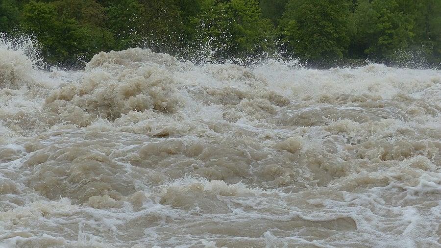
Representative image of flood.
Credit: Pixabay Photo
The recent flash floods in Pakistan and India’s northern states highlight gaps in disaster preparedness beyond meteorological forecasting capabilities. These events have caused large-scale destruction, all despite IMD warnings. While India’s reported decision to share hydrological data with Pakistan during its crisis demonstrated regional cooperation, the country lost over 800 lives and reported economic losses that remain difficult to assess. These disasters highlight a fundamental shortcoming in disaster management that needs to be looked into.
Flash floods, with their unpredictable intensity, are increasingly impacting a wide array of geographical settings and socio-economic groups, ranging from mountainous regions to low-lying plains, and from rural communities to dense urban centres. Each context experiences unique contributing factors, necessitating tailored mitigation strategies. Such complexity emphasises the urgent need to go beyond the limited scenario of flood risk and hazard-zoning assessments for specific projects like hydropower or agriculture. A comprehensive, compulsory flood risk assessment should be applied across the spectrum of planning domains, including urban development and industrial site selection, to avert future catastrophes.
Climate data shows that flood risks are getting worse worldwide. It is observed that flash floods are occurring much more frequently in India. Cities are also seeing more flooding as their drainage systems can’t handle the increased rainfall, and coastal areas face double trouble from both storm surges and heavy rain. The financial costs are scary – global losses from natural disasters crossed $400 billion in 2024. Given these increasing costs, comprehensive flood hazard mapping is no longer optional but essential.
Flash floods are considered dangerous because of their lethal nature, speed, and unpredictability. They are formed in a matter of minutes by intense rainfall, glacial lake outbursts, or dam failures, mostly on steep terrains or where drainage infrastructure is inadequate, leaving very little time for evacuation and preparedness. Urban flooding results from a combination of heavy rainfall and poorly designed drainage systems, sometimes escalating into flash flood scenarios.
Effective flood risk assessment demands systematic integration of geospatial technology with hydrological analysis. Initially, substantial amounts of data using both satellite-based remote-sensing and ground-based monitoring stations is collected. This information is analysed using Geographic Information Systems (GIS) that aggregate and examine spatial data from many other sources. They include historical flood records, precipitation data, and topographic information to build a foundation for understanding past flood behaviour and predicting future risks.
Geospatial technology is already becoming a game-changer in these risk assessments, and its full potential is still being explored. It can analyse digital flood-related data. These include remote-sensing as well as ground-based data. Remote-sensing data, collated with technologies such as LiDAR (Light Detection and Ranging) provides high-resolution mapping of terrain and topography. This helps in creating digital elevation models (DEM), which are representations of ground surface elevation that help in determining the flow of water across landscapes.
With this data, it is possible to digitally build different situations ranging from small and frequent floods to the rare huge floods, and develop a better understanding of risks. It can also combine regional demographic data with flood hazard maps to find locations of vulnerable communities and assess the impact on critical infrastructure and emergency services.
Access for innovation
Real-time data integration systems have demonstrated significant potential in flood management by combining live information from weather stations, river monitors, and satellites into GIS platforms, enabling authorities to provide risk updates and early warnings to vulnerable communities. A successful model is Japan’s Automated Meteorological Data Acquisition System (AMeDAS) and J-Alert, which turns flood management from a static planning process into a dynamic response adaptable to changing conditions.
In India, however, most of this data remains confined mostly to government agencies, or only allows visualisation. Ensuring broader access to researchers, planners, and other stakeholders can significantly improve the quality of flood assessment and bring innovation in data analysis methods.
These extreme weather events occurring due to various reasons, including climate change, necessitate the need for holistic and geospatial tech-powered flood risk assessment to ensure life-livelihood protection and sustainable development. Advanced geospatial technology and traditional hydrological analysis together serve as a tool for understanding and managing these risks. However, all of this depends on reliable data access, periodic modelling, and the political will for integrating results into real-world planning and policy.
Investment in these capabilities is socially imperative. The economic costs of comprehensive flood risk assessment are justified by the potential consequences of flooding in an unprepared community.
(The writer is a geospatial research analyst at the Takshashila Institution)