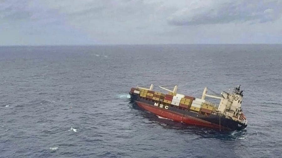
Liberian vessel carrying marine fuel lists off Kerala coast that spilled cargo into sea.
Credit: PTI Photo
Following accidents involving the Liberian vessel MSC ELSA 3 and the Singaporean container MV Wan Hai 503, both along Kerala’s coast, the Arabian Sea’s vulnerability to marine transit hazards was further exposed when oil tankers ADALYNN and Front Eagle collided near the Strait of Hormuz on June 17, sparking massive fires. These back-to-back incidents underscore a critical reality:
as India’s maritime traffic surges, so does its exposure to oil spills that demand immediate policy intervention and technological upgrades.
The response to such incidents demonstrates both India’s maritime monitoring capabilities and critical gaps that threaten long-term coastal security. The Indian National Centre for Ocean Information Services (INCOIS), Indian Coast Guard (ICG), and Central Marine Fisheries Research Institute (CMFRI) coordinated effectively to monitor the oil slick and implement containment measures soon after the sinking of the Liberian vessel. CMFRI’s ongoing coastal surveys following the accidents can be extremely useful for disaster management by the country’s coastal states.
ISRO’s EOS-04 satellite provided spatial images, using Synthetic Aperture Radar (SAR) sensors capable of monitoring oil spills regardless of lighting or weather. However, this reliance on a primarily Earth observation satellite highlights a concerning gap in India’s dedicated ocean monitoring infrastructure. The
dependence on multi-purpose satellites creates potential conflicts between monitoring priorities and limits specialised maritime surveillance capabilities.
India’s current oil spill trajectory modelling relies on adapted versions of the US National Oceanic and Atmospheric Administration (NOAA)’s General NOAA Operational Modelling Environment (GNOME) tool. These generalised international models using broad parameters and spatial data of coarse resolutions might struggle with India’s unique peninsular coastline, without localised data inputs and specialised algorithms to predict oil spill behaviour. These limitations become pronounced during monsoon periods, when tropical ocean patterns dramatically alter, necessitating a region-specific technology deployment. More critically, the sensors can only detect oil presence or absence, not its types – information crucial for determining appropriate response strategies.
Oil spills create cascading impacts across sectors and environmental damage beyond visible contamination – from marine biodiversity to coastal economy, from health impact on coastal communities to losses in the energy sector. Yet these impacts rarely factor into policy discussions.
Perhaps most concerning is the absence of comprehensive regulatory frameworks governing maritime pollution incidents. The absence of mandatory state-level oil spill contingency plans for vessels transiting Indian waters represents a significant policy gap. The State Disaster Management Authority (SDMA) also lacks independent capacity including boats and satellite data, enhancing dependencies on central agencies.
Containment to intervention
India’s National Oil Spill Disaster Contingency Plan, last updated in 2014, suffers from weak enforcement mechanisms and fragmented institutional oversight. The divided but overlapping authority between ICG, Pollution Control Boards, port authorities, and Directorate General of Shipping creates coordination challenges leading to delays in legal action against polluters. The tiered response structure also creates bureaucratic bottlenecks during major incidents.
The recent incidents highlight the need to focus on addressing India’s maritime vulnerability that requires dedicated technological infrastructure designed for ocean monitoring. Deploying satellites with advanced sensors capable of oil type identification would enable real-time characterisation of pollutants, allowing immediate deployment of appropriate response technologies. These sensors, already available, could transform response effectiveness from generic containment to targeted intervention.
Operational and decentralised geospatial dashboards integrating real-time satellite data, weather information, vessel tracking, and response resource locations would provide comprehensive situational awareness. Enhanced inter-agency coordination between state disaster management authorities and national agencies like INCOIS and ICG requires structured training programmes and regular joint exercises. Rather than expecting universal expertise, shared capacity-building can enable seamless coordination during emergencies. Regular interactive training exercises in the state’s specific geographic conditions would identify operational gaps and improve response protocols.
The Kerala chapter shows that the maritime future of Indian coastal states depends on transforming reactive crisis management into proactive risk prevention. This requires immediate investments in dedicated ocean monitoring satellites, comprehensive regulatory frameworks with robust accountability measures, and integrated response systems designed specifically for India’s tropical coastal environment. The technology exists – what’s needed is commitment to implement comprehensive maritime ecological safeguards before the next inevitable spill tests India’s resilience.
(The writer is a research analyst at the Takshashila Institution)