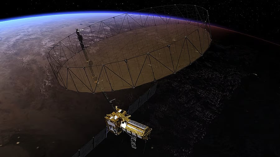
Artist's concept of NISAR
Credit: NASA
Chennai: NISAR, an ambitious joint mission by NASA and ISRO aimed at measuring Earth’s changing ecosystems, dynamic surfaces, and ice masses—which provides information about biomass, natural hazards, and groundwater—is likely to be launched by the end of July from the Satish Dhawan Space Centre in Sriharikota.
The planned launch follows just days after Indian Air Force Group Captain Shubhanshu Shukla’s successful return to Earth from the International Space Station (ISS) aboard SpaceX’s Dragon spacecraft—a demonstration of the strong collaboration between India and the US in the space sector.
Both the satellite and the Geosynchronous Launch Vehicle (GSLV) are currently at the Satish Dhawan Space Centre. “We are targeting a July-end launch for the NISAR mission,” a source aware of the development told DH.
The mission will lift off from the second launchpad at SDSC, Sriharikota. NISAR carries two radars: the L-band radar developed by ISRO and the S-band radar by NASA’s Jet Propulsion Laboratory (JPL). The entire system was integrated and tested at the U R Rao Satellite Centre in Bengaluru before being transported to Sriharikota.
The mission’s objective is to observe Earth’s land and ice-covered surfaces globally with 12-day regularity on ascending and descending passes, effectively sampling Earth every 6 days on average for a baseline three-year mission.
NASA is scheduled to host a virtual news conference for Indian journalists on NISAR this Monday. The conference will be addressed by Nicky Fox, Associate Administrator, Science Mission Directorate; Karen St. Germain, Director, Earth Science Division; Wendy Edelstein, Deputy Project Manager, NISAR; and Paul Rosen, Project Scientist, all from NASA or NASA JPL.
The mission will also provide a three-dimensional view of Earth in unprecedented detail. NISAR will be the first satellite mission to collect radar data simultaneously in two microwave frequency bands—L-band and S-band—to measure changes on the planet’s surface, including movements as small as a centimetre.
This capability will allow the mission to observe a wide range of Earth processes, from glacier flow rates and ice sheet dynamics to earthquakes and volcanic activities.
NISAR employs a sophisticated information-processing technique known as synthetic aperture radar to produce extremely high-resolution images.
“Radar penetrates clouds and darkness, enabling NISAR to collect data day and night, in any weather,” ISRO said. “The instrument’s imaging swath—that is, the width of the data strip collected along the orbit track—is greater than 150 miles (240 kilometers), which allows it to image the entire Earth every 12 days.”
As the mission continues over the years, the data collected will enhance our understanding of the causes and consequences of land surface changes, improving our ability to manage resources and prepare for, and cope with, global change.