In southwest Bolivia, a vast white landscape called the Salar de Uyuni behaves in a way that feels almost impossible. During certain months, rocky islands covered with cactus seem to vanish completely. A few months later, the same islands rise back into view as if nothing happened. This dramatic change is caused by seasonal water movement across the world’s largest salt flat.
For most of the year, Salar de Uyuni is dry, forming a hard, crusted surface of salt left behind by an ancient prehistoric lake. Scattered across this salt crust are rocky islands made of volcanic stone. These islands are not floating; they are fixed landforms that rise above the flat.
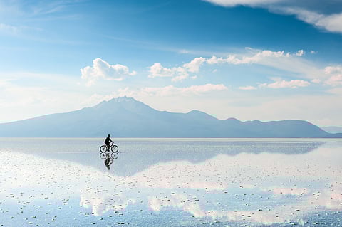
During Bolivia’s rainy season, water from surrounding mountains flows into the salt flat. Because the surface is perfectly level, even a shallow layer of rainwater spreads evenly across hundreds of kilometres. The water collects around the rocky islands and slowly rises, covering their bases and then their slopes.
As the water level increases, the islands appear to shrink. Eventually, only their highest points remain visible. When cloud cover and reflections combine, the islands seem to disappear entirely beneath a vast shallow lake. This effect is strongest between January and March.
When the rains stop, evaporation begins. The intense high-altitude sun causes the water to retreat evenly, revealing the islands once again. Salt crystals reform on the surface, locking the landscape back into its dry state.
The islands were never swallowed or destroyed. They were simply hidden by a temporary lake that comes and goes with the seasons.