Long before GPS, satellite images or even written directions, humans faced a simple but serious problem: how do you remember where things are? Where is the river that leads home? Where does the land become dangerous? Where does food grow? The very first maps were born from this need.
The earliest maps were not drawn on paper. They lived inside human memory. Early humans remembered landscapes by walking them again and again, turning paths, hills and water sources into mental pictures. Stories helped keep these maps alive. Elders described journeys using landmarks: a bent tree, a sharp rock, the place where the sun sets behind a hill. These spoken maps were passed from one generation to the next.
Eventually, humans began turning memory into markings. Some of the oldest known maps are simple carvings on stone. In parts of Europe and Asia, archaeologists have found rock engravings showing rivers, hunting grounds and settlements. These were not accurate by modern standards, but they captured what mattered most. Direction was less important than meaning. A river might appear larger than a mountain because water meant life.
As civilisations developed, maps became more deliberate. In ancient Mesopotamia, one of the world’s earliest known drawn maps appeared on a clay tablet around 2,500 BCE. It showed a city, surrounding land and a river, all etched into wet clay and baked hard. This map was small enough to fit in a hand, but it marked a major shift — humans were now fixing space onto objects that could be shared.
In ancient Egypt, maps took on a new purpose. They were used not just for travel, but for planning. Egyptians mapped fields along the Nile to record land ownership after floods reshaped the riverbanks each year. They also created maps for mining expeditions, showing roads, water sources and stone quarries. These maps were practical tools, tied closely to daily life and work.
Meanwhile, ancient Babylonian and Greek thinkers began asking deeper questions. Was the world flat or round? Where did land end and sea begin? Greek scholars such as Anaximander attempted to draw the entire known world on a single surface. These early world maps placed their own regions at the centre, surrounded by ocean. Accuracy was limited, but imagination was expanding.
One of the most important breakthroughs came from observation of the sky. By watching the sun, stars and shadows, early mapmakers learned how to find direction. The idea of north, south, east and west slowly took shape. Greek scientist Eratosthenes even calculated the Earth’s circumference with surprising accuracy by measuring shadows at different locations. This showed that maps could be based on mathematics, not just experience.
In ancient China, mapmaking followed a different path. Chinese maps focused on balance, administration and control. They were often drawn on silk or paper and used grid systems to represent distance. Rivers, roads and administrative regions were carefully marked. These maps were tools of governance, helping rulers manage vast territories.
Maps in ancient India also combined practicality with belief. Early Indian maps were often linked to pilgrimage routes, trade paths and cosmology. Rather than strict scale, they focused on relationships between places. Sacred rivers, mountains and cities were highlighted, showing how geography and culture were deeply connected.
As trade expanded, so did the need for better maps. Sailors required charts to cross open seas. Coastal maps, called portolan charts, emerged around the Mediterranean. These maps were filled with lines radiating from compass points, helping sailors plot courses. They were drawn from experience; each voyage refining the map a little more.
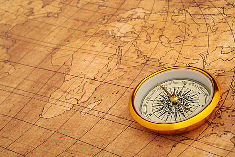
The invention of the compass changed everything. Direction could now be found even when the sun or stars were hidden. This made maps more reliable and encouraged longer journeys. Exploration pushed mapmakers to redraw the world again and again. Blank spaces slowly filled in, though mistakes remained common. Some maps showed imaginary islands or sea monsters, reflecting fear of the unknown.
Maps were never neutral. They reflected power, belief and perspective. Many early maps placed the mapmaker’s homeland at the centre. Some showed religious ideas, placing sacred locations prominently while shrinking distant lands. Accuracy improved over time, but maps always told a story about how people saw the world.
The printing press allowed maps to spread widely. What was once secret knowledge became shared understanding. Over centuries, measurements improved, tools advanced and science refined mapmaking into the precise discipline we know today.
Yet the heart of mapmaking has not changed. The first maps were created because humans wanted to understand their place in the world. Whether scratched into stone, painted on silk or printed on paper, maps were a way of saying, this is where we are, and this is how we move forward.
