A requiem for Hanamsagar, India’s largest stone alignment


The invading army swarmed up and across the low, boulder-strewn hills from the north and the east. Hardly breaking formation, they marched across the plain ground encircled by the hills, intent on their target — a golden cradle suspended between two tall boulders on the ridgeline in the southwest. However, as the leader of the army approached the cradle and reached out to grab it, the entire army was transformed to stone.
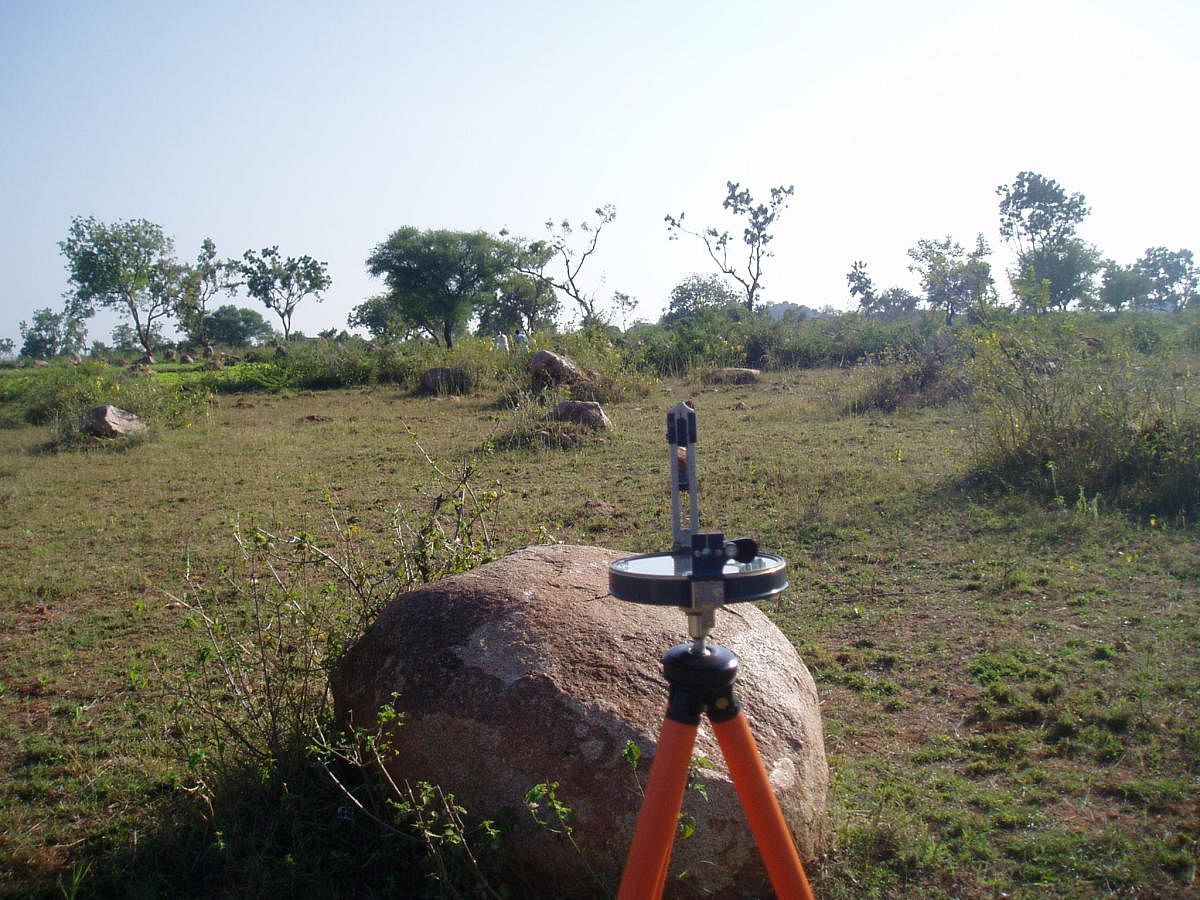
When I visited in January 2008, this petrified army occupied a field known as “Salgal Bayalu” (the field with the stone rows), near Hanamsagar village, Shorapur Taluk of Yadgir District. Narrating this tale, the villagers pointed out the stones stretched out, seemingly endlessly, in rows oriented to the cardinal directions, as well as diagonally. One large boulder in the southwest was said to be an elephant which was part of the army too.
Archaeologists have a different take on such arrangements of stones, though. Termed ‘stone alignments’, they are somewhat tenuously categorised under the class of prehistoric monuments called megaliths. Most megaliths are funerary or commemorative in nature. They are built in memory of long-departed ancestors and are loosely coincident with the Iron Age, about 2,500 to 3,500 years ago.
The stone alignments
Stone alignments are a special category of megaliths, with no apparent purpose. The archaeologist F R Allchin identified 43 such alignments, all located north of the Tungabhadra and Krishna rivers. Sadly, most of these monuments have been destroyed in recent years.
Allchin proposed that stone alignments are connected with megalithic culture mainly because several of these alignments occurred in close proximity to megalithic monuments like stone circles and cists (ancient tombs). However, some archaeologists also opine that these alignments could pre-date the Iron Age and belong to the preceding Neolithic period.
Fascinated by the possible purpose for which such alignments of stones were made, Allchin ventured guesses ranging from markers delineating caravan-halting spots to ‘magical’ arrangements of stones to prevent epidemics among cattle. Researchers have also wondered if such grids of stones were laid out to aid observations of the celestial cycles, as a sort of calendar device to keep track of time.
Renowned archaeologist K Paddayya, who studied the stone alignment at Hanamsagar, has shown that the site is not an isolated artefact of the prehistoric period, but one component in an ancient landscape dotted with archaeological features like Neolithic ash mounds, a Mesolithic habitation site and megaliths. He estimated that it comprised of over 2,500 stones arranged in a staggered grid.
Staggered grid
In 2008, due to paucity of time, I contented myself with taking a few compass bearings at random positions within the array, rather than an exhaustive survey of the alignment. Allchin had mentioned that all the stone alignments he had listed were either grids or staggered grids — where alternate rows were offset by half the separation between stones, aligned to the cardinal directions.
My survey showed that while the north-south alignments were quite accurate, the bearing to the east showed a large deviation. To resolve this, I photographed the alignment from the hilltop in the west. This view showed the rows of stones curving away in concentric arcs towards the northeast. The shape of the stone alignment was not a rectangular grid as supposed earlier, but long, arcuate segments.
I noticed the carving of a bull on a large, sloping rock face on the hill, probably from the same prehistoric period as the alignment, but unfortunately marred by modern graffiti. The hilltop was littered with boulders of various sizes — clearly, the boulders that comprised the stone alignment were rolled down from the surrounding rocky hillsides and manoeuvred into position. Most boulders within the array appear unmodified, with only a few sporting signs of minimal dressing.
With over 2,500 stones, the alignment at Hanamsagar was undoubtedly the most extensive of such formations in India. A similar monument exists at Carnac, in Brittany, France, where rows of around 3,000 menhirs were erected in three alignments in prehistoric times. Though the Carnac alignments, too, continue to baffle scholars, it is speculated that they were built to observe the cycles of the moon.
It was when plans were afoot to conduct an aerial survey of the Hanamsagar alignment, that I heard the devastating news from a fellow megalith enthusiast and professor, Serge Le Guirriec, of Brittany. Without the status of a protected archaeological site, the great structure was unwittingly destroyed when the land was cleared for agriculture.
It must have taken mere hours for earth movers to undo the months of backbreaking labour of the ancient megalith-builders. Photographs show that the entire area has been converted into fields, with the displaced stones lining their peripheries.
Back in 2008, a villager had pointed out the location on the western ridgeline where the golden cradle of the legend had been allegedly suspended. One of the diagonal rows of rocks in the southeastern quadrant of the alignment seemed to point exactly towards this.
On a whim, I took a compass bearing along this sightline. I was stunned to note that the azimuth indicated the position where the sun would set on the winter solstice day! The setting sun of the shortest day of the year — was that the golden cradle? Unfortunately, this question can never be answered now. The stones of Hanamsagar have been silenced forever.
(The author is with the National Institute of Advanced Studies, Bengaluru)