
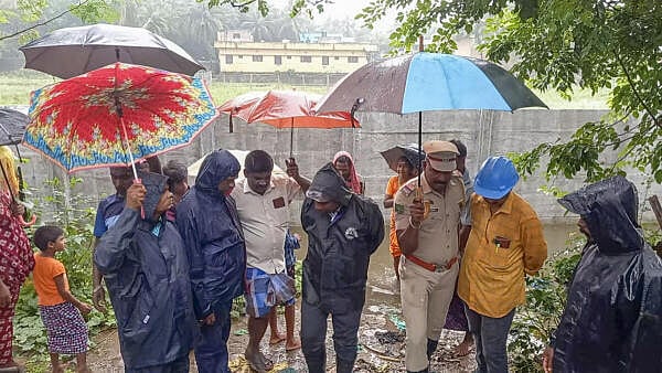
Collector Manikandan visits the rain-affected areas to take stock of sitution amidst severe weather conditions owing to deep depression in Bay of Bengal, in Karaikal district, Thursday, Nov. 28, 2024.
PTI
Rains lash several parts of Tamil Nadu, cyclonic storm threatens coastal areas
Cyclone Fengal, named by Saudi Arabia, and is likely to cross between Chennai and Puducherry coasts between November 29 and November 30, according to weather experts.
The entire coastline from Vedaranyam in Nagapattinam to Puducherry, including Mayiladuthurai, Tharangambadi, Thiruvarur, Cuddalore, and Velankanni received extremely heavy rainfall on November 25-26, even as several areas in Chennai and its neighbouring districts of Tiruvallur, Kanchipuram, and Chengalpattu received heavy rainfall.
Read more
Rains continue to affect Tamil Nadu, standing crops hit in Cauvery delta areas
Rains continued throughout Wednesday (November 27) in Tamil Nadu's Cauvery delta areas affecting standing paddy crops, and leader of the opposition, Edappadi K Palaniswami urged the state government to provide appropriate relief to farmers.
Crops were submerged partially and completely at several places, including those in and around Tiruvarur, Thiruthuraipoondi, Muthupettai, Mayiladuthurai, and Vedaranyam, and according to farmers' rough estimates, crops on at least 2,000 acres were acres were affected.
-PTI
Read more
Navy gears up to render support to the vulnerable areas ahead of Cyclone Fengal's landfall
Cyclonic storm with wind speeds of 65-75 kmph gusting to 85 kmph expected over the course of next 2 days: IMD
The deep depression over the Southwest Bay of Bengal will intensify into a cyclonic storm in the next 12 hours
The deep depression over the Southwest Bay of Bengal remained practically stationary about 100 km east-northeast of Trincomalee and it will intensify into a cyclonic storm in the next 12 hours, the Regional Meteorological Centre, Chennai, said on Thursday.
It would move nearly north-northwestwards, skirting Sri Lanka coast and intensify into a cyclonic storm during the next 12 hours, the RMC said in its latest bulletin.
"To cross the north Tamil Nadu-Puducherry coasts between Karaikal and Mahabalipuram around the morning of November 30, as a deep depression with a wind speed of 50-60 kmph gusting to 70 kmph," it said. (PTI)
Deep depression stationary over Bay of Bengal, to cross Karaikal-Mahabalipuram: IMD
In a statement the IMD said, the cyclone will cross north Tamil Nadu-Puducherry coasts between Karaikal and Mahabalipuram around morning of 30th November as a deep depression with a wind speed of 50-60 kmph gusting to 70 kmph.
There is a possibility of marginal intensification of the deep depression into a Cyclonic Storm with wind speed 65-75kmph gusting to 85 kmph over southwest Bay of Bengal during the evening of 28th November to morning of 29th November 2024.
IMD has issued a warning to fishermen not to venture out into the sea, deep depression expected to intensify into a cyclonic storm
IMD has issued a warning to fishermen not to venture out into the sea as the Deep Depression over Southwest Bay of Bengal is expected to intensify into a cyclonic storm during the evening of 28th November to morning of 29th November.
Indian Navy prepares disaster response plan for relief operations
Chennai wakes up to a foggy morning
Details of Indian Navy's disaster response plan
A comprehensive disaster response plan has been activated by the Navy, guided by the National Disaster Management Authority's (NDMA) guidelines, as Cyclone Fengal intensifies. The Easter Naval Command, in coordination with the Headquarters Tamil Nadu and Puducherry Naval Area (HQTN&P), has activated a disaster response mechanism to mitigate the cyclone's potential effects, ANI reported.
Naval authorities are working closely with state and civil administrations, focusing on Humanitarian Assistance and Disaster Relief (HADR) and Search and Rescue (SAR) operations to ensure rapid response capabilities.
Essential relief materials - food, drinking water and medicines, have been loaded into vehicles. Specialised Flood Relief Teams are being positioned in vulnerable areas.
HQTN&P diving teams are on high alert, ready to undertake emergency rescue missions if required.
The Indian Navy prepare emergency supplies, which include stockpiling food, water, MREs and medical supplies to support the affected communities, search and rescue, which includes positioning naval personnel, including Geminis and helicopters for quick response to SAR requirements. Warships are being loaded with HADR relief materials.
The India Navy continues to monitor the situation closely and is committed to supporting the affected personnel and ensuring their safety during Cyclone Fengal.
IMD update, cyclone likely to move north-northwestwards skirting Sri Lanka coast during next 12 hours.
The IMD reported that the Deep Depression over Southwest Bay of Bengal remained practically stationary during past 06 hours and lay centred at 0830 hours IST of today, the 28th November 2024 over the same region near latitude 9.1°N and longitude 82.1°E, about 110 km east-northeast of Trincomalee, 310 km southeast of Nagappattinam, 410 km southeast of Puducherry and 480 km south-southeast of Chennai.
It is very likely to move nearly north-northwestwards skirting Sri Lanka coast during next 12 hours. Thereafter, it will continue to move north-northwestwards and cross north Tamil Nadu-Puducherry coasts between Karaikal and Mahabalipuram around morning of 30th November as a deep depression with a wind speed of 50-60 kmph gusting to 70 kmph.
There is a possibility of marginal intensification of the deep depression into a Cyclonic Storm with wind speed 65-75 kmph gusting to 85 kmph over southwest Bay of Bengal during the evening of 28th November to morning of 29th November 2024.
Heavy rainfall likely to occur over Tamil Nadu, Puducherry & Karaikal today
IndiGo issues new advisory
Sri Lanka notifies strong wind alert
High wave alert in Karaikal, Nagappattinam,
Red alert for two districts in Andhra
The India Meteorological Department (IMD) has issued a red alert for Tirupati and Nellore districts in Andhra Pradesh for November 29 as very heavy to extremely heavy rainfall is expected in this region under the influence of the deep depression over the Bay of Bengal.
Forecast: The deep depression over Southwest Bay of Bengal is very likely to continue to move nearly north-northwestwards skirting the Sri Lankan coast and intensify into a cyclonic storm in the next 12 hours, as per a storm advisory released at 14:20 Hrs by the Regional Metereological Centre, Chennai. Thereafter, it will continue to move north-northwestwards and cross north Tamil Nadu-Puducherry coasts between Karaikal and Mahabalipuram around morning of 30th November as a deep depression with a wind speed of 50-60 kmph gusting to 70 kmph. The system is forecast to move north-northwest, skirting the Sri Lankan coast, and will strengthen as it progresses.
Cuddalore Monitoring Officer Mr. Raman, IAS, inspected various sites to assess the progress of relief efforts amidst ongoing weather challenges
State Disaster Management Authority: Tamil Nadu alerts
Heavy rainfall to hit Kerala, and Karnataka as well, says IMD
IMD's update indicates that the cyclonic storm is expected to bring very heavy rainfall not only to Tamil Nadu and Andhra Pradesh on November 30, but also to Kerala and Karnataka. They predict that the cyclonic storm will result in very heavy rainfall over coastal Andhra Pradesh and Yanam, Rayalaseema, south interior Karnataka, Kerala and Mahe, marking an orange alert for those areas. Andaman and Nicobar are likely to receive heavy rainfall too.
Highways Department removed accumulated rainwater in Thathangudi Panchayat, Mayiladuthurai
Delay in cyclone formation
S. Balachandran, Additional Director General of Meteorology, Chennai, said there is a possibility of marginal intensification of the deep depression into a cyclonic storm over the Bay of Bengal between Thursday evening and Friday morning. It may not be a strong cyclone.
On the factors that led to the delay in forming of the cyclone, Balachandran said wind convergence in the lower level of the weather system reduced on Wednesday, as per a Hindu report.
Rain holiday in Cuddalore on Friday, Nov 29
Cyclone movement: IMD report @ 1730 hours
The Deep Depression over Southwest Bay of Bengal moved northeastwards with a speedof 10 Kmph during past 6 hours and lay centred at 1730 hours IST of today, over the same region — [latitude 9.6°N and longitude 82.7°E, about 200 km northeast of Trincomalee].
It is very likely to move nearly northwards and maintain its intensity of deep depression till morning of 29th November. Thereafter, it will move north-westwards, weaken gradually into a depression by evening of 29th November. Continuing to move further northwestwards, it is very likely to cross north Tamil Nadu-Puducherry coasts between Karaikal and Mahabalipuram around the morning hours of 30th November as a depression with a wind speed of 45-55 kmph, gusting to 65 kmph.
IMD
Heavy rain forecast: Pondy govt declares holiday for educational institutions on Nov 29, 30
The Puducherry government on Thursday announced that all schools and colleges in the union territory will remain closed on November 29 and 30 as heavy rains were forecast under the impact of cyclone Fengal brewing over Bay of Bengal. Home Minister A Namassivayam told reporters that all schools and colleges in Puducherry and Karaikal regions would remain shut for two days from Friday in view of rains. All privately managed schools and government aided schools would also be closed.
'Deep Depression' on track without any further intensification; likely to cross Tamil Nadu coast as a 'Depression' on Nov 30 morning: IMD
What is the difference between low, depression and cyclone alerts?
12 Cyclone safety tips to follow
Credit: X/@tnsdma
Credit: X/@tnsdma
Credit: X/@tnsdma
Credit: X/@tnsdma
Annamalai University, affiliated colleges postpone exams on November 29 in four districts
Latest Nov 29 alerts for heavy to very heavy rainfall
Scattered heavy to very heavy rain with extremely heavy rain at one or two places is likely to occur over Chengalpattu, Villupuram, Cuddalore, Mayiladuthurai, Tiruvarur, Nagapattinam districts, Puducherry and Karaikal area.
Heavy rain is likely to occur at isolated places over Chengalpattu, Villupuram, Cuddalore, Mayiladuthurai, Nagapattinam, Tiruvarur, Thanjavur, Pudukkottai, Ariyalur districts, Puducherry and Karaikal area.
Heavy to very heavy rain is likely to occur at a few places over Chennai, Tiruvallur, Kancheepuram, Ariyalur and Thanjavur districts.
Heavy rain is likely to occur at isolated places over Ranipet, Tiruvannamalai, Kallakurichi, Perambalur, Tiruchirappalli, Pudukkottai, Sivaganga and Ramanathapuram districts.