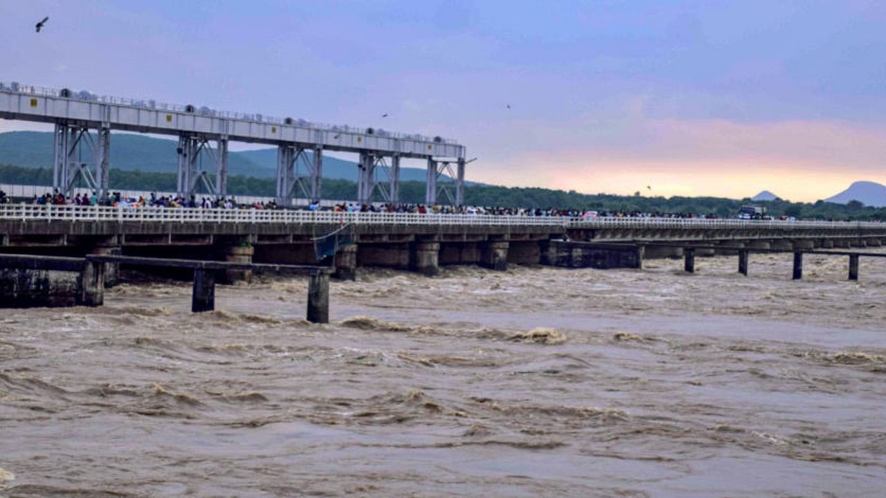
The IMD on Friday rejected speculations of the deep depression over Bay of Bengal intensifying into a cyclone, even as several places in Odisha were pounded by heavy rain under the impact of the weather system.
The deep depression over northwest and adjoining northeast Bay of Bengal moved west-northwestwards during the past six hours with a speed of 14 kmph, and lay centered at 5.30 pm over northwest Bay of Bengal, the IMD said in a bulletin. Earlier, social media was flooded with posts on the possibility of a cyclone, following a warning by the US Joint Typhoon Warning Center’s (JTWC) on Thursday.
“There is no possibility of a cyclone this time. We have never said that the system will take the shape of a cyclone,” India Meteorological Department (IMD) Director General Mrutunjay Mohapatra told PTI.
The system will move along the coast as a deep depression at a wind speed of 60 to 65 kmph and it is unlikely to intensify further, he said.
The bulletin added that continuing to move west-northwestwards, the weather system crossed West Bengal and adjoining north Odisha coasts between Balasore and Sagar Islands, close to Digha during 7 pm to 8 pm on Friday.
It would continue to move west-northwestwards across West Bengal, north Odisha and Jharkhand towards north Chhattisgarh during the next 24 hours and weaken gradually.
Under its influence, squally surface winds reaching speeds of up to 55-65 kmph is expected in coastal areas and 30-40 kmph in interior districts of Odisha.
Odisha Special Relief Commissioner (SRC) P K Jena told reporters that the system has made landfall and under its impact, northern districts of the state will receive heavy rainfall till Saturday morning.
Rainfall is expected in the interior parts of Odisha, Chhattisgarh and Jharkhand later on Saturday as well, he said.
The IMD has issued a ‘red’ warning for heavy to very heavy rainfall in Keonjhar, Bhadrak, Balasore and Mayurbhanj districts till 8.30 am on Saturday.
It has also forecast heavy to very heavy rainfall at a few places in districts like Kendrapada, Jagatsinghpur, Cuttack, Dhenkanal, Angul, Deogarh, Sundargarh, Sambalpur, Sonepur, Boudh, Balangir and Jajpur during this period.
Deccan Herald is on WhatsApp Channels| Join now for Breaking News & Editor's Picks