
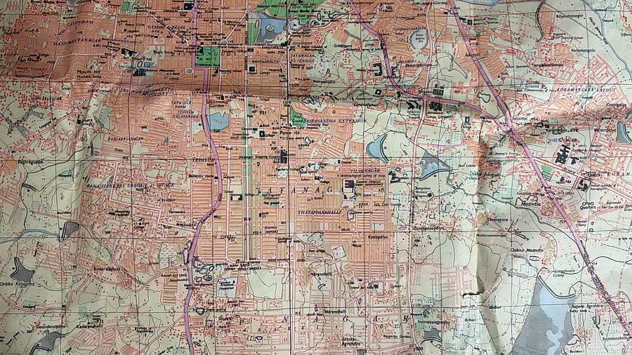
1983 Bengaluru map
Credit: X/@dravishakatoch
A decades old map of Bengaluru has gone viral on social media. The 42-year-old map showed Jayanagar as the central part of the city, while Indiranagar was hardly visible and HSR Layout did not even exist.
A resident of Bengaluru bought the 1983 edition map from a collector, and posted it on social media, garnering much attention.
“We bought Bengaluru’s map (1983 edition) from a collector. And it turns out, HSR & Indiranagar are non-existent. Jayanagar is almost central of the city. Now, onto finding our favourite places on the map and see if they existed back then," the person wrote in the post.
She also mentioned that the map covered the entire city including prominent areas like MG Road, Shivajinagar, Whitefield, etc. However, South Bengaluru appeared to be more developed back then, compared to the northern parts of the city.
The rare map made many nostalgic with many asking the person to upload a HD version of it. "Pls make a very high resolution scan and open source it. Lots of us would love to access it for research purposes," said a user.
"super cool! Jayangar deserves to be central ... then and now," said another.