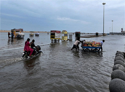
The brief respite for people in rain-battered Tamil Nadu has ended even as another low-pressure in the Bay of Bengal is expected to bring heavy downpour in the next two days.
“A new trough of low pressure over southwest region off Sri Lanka coast, which lies near Cape Comorin area, is likely to move towards Tamil Nadu. Due to this system, heavy rain is expected to occur over coastal areas of the state in the next 48 hours,” a senior official from regional Meteorological Centre here told Deccan Herald on Sunday evening.
This is the third low pressure area in a span of just two weeks. The first low pressure area, which developed as deep depression and devastated Cuddalore district, has claimed more than 50 lives in that region.
The second brought heavy rain to the northern districts of Tamil Nadu before it moved to neighbouring Andhra Pradesh a couple of days ago.
According to the latest weather bulletin, isolated heavy to very heavy rain would occur over coastal Tamil Nadu and Puducherry and isolated heavy rain may occur in interior Tamil Nadu.
The official said the sea would remain very rough along north Tamil Nadu and Puducherry and coasts during the next 48 hours.
Fishermen from Tamil Nadu were warned not to venture into sea as strong onshore winds from easterly direction will blow with a speed of 55 KM per hour along the coast.
Heavy rain started to hit coastal Tamil Nadu from Sunday afternoon.
Deccan Herald is on WhatsApp Channels | Join now for Breaking News & Editor's Picks