Odisha Friday launched a massive drive to evacuate coastal villages as the severe cyclonic storm Phailin is advancing from the Bay of Bengal and is expected to make landfall Saturday evening.
The state government has planned to evacuate about a half million people along the coast. "We have so far moved two lakh people to safer places, the remaining would be shifted late today (Friday) night", a senior disaster management department official told IANS.
While more than 5,000 families from low-lying areas of the beach town of Puri have already been moved to safer places, authorities plan to move more than 30,000 others in the area later in the day.
In Ganjam district, which is expected take the worst hit as the cyclone is likely to make landfall near its Gopalpur town, authorities have started moving 100,000 families from low-lying areas to safer places like cyclone shelters and school buildings, he said.
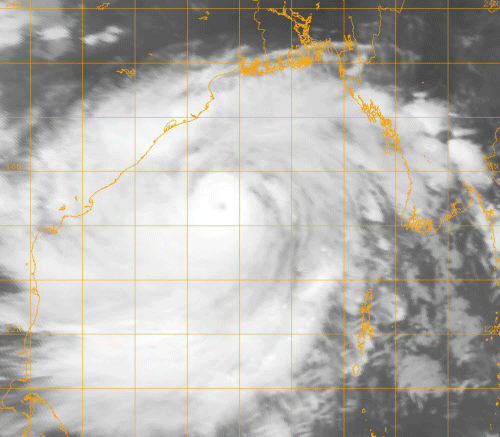
The storm over east-central Bay of Bengal moved north-westwards and lay centred about 500 km south-southeast of Paradip in Jagatsinghpur district and 490 km southeast of Gopalpur in Ganjam district in Odisha, S.C. Sahu, director of the Bhubaneswar Meteorological Centre, told IANS.
It would move north-westwards and cross north Andhra Pradesh and Odisha coast between Kalingapatnam and Paradip, close to Gopalpur in Odisha, by Saturday evening, as a very severe cyclonic storm with a maximum sustained wind speed of 210-220 kmph, he said.
The state government said it has heightened preparedness to deal with the cyclone, which could cause devastation in the state's southern coastal districts.
Stocks of food grain and other essential commodities are being put together in cyclone relief centres so that people do not face difficulties. Arrangements are being made to provide people cooked food at relief centres.
Relief and rescue officials have already arrived at vulnerable places, in readiness to start operations as soon as required. At least 28 teams of National Disaster Response Force (NDRF) would also be pressed into relief and rescue work.
Ten such teams were already deployed in Ganjam district, and two are kept on stand-by at the Biju Patnaik Airport in the state capital.
Deputy Inspector General Surjeet Singh Guleria of the NDRF said more forces are likely to reach the state, if required.
Chief Minister Naveen Patnaik appealed to people to stay calm and assist local administration in handling the crisis. "The government is fully prepared," Patnaik told reporters.
Many coastal regions witnessed rain and squally weather Friday afternoon. The weather office said squally winds would increase in intensity, with gale wind speeds reaching 205-215 kmph along and off coastal districts of south Odisha at the time of the cyclone's landfall.
The sea along and off the state coast was rough to very rough, officials said.
The weather office, in its latest bulletin, also said that many places in the state are likely to witness widespread, heavy rainfall in the next two days.
Storm surge with height of more than 2.0-2.5 metre would inundate low lying areas of Ganjam, Khurda, Puri and Jagatsinghpur districts during landfall.
The state government has instructed officials in 14 districts that are likely to be affected by the cyclone to stay on alert.
Deccan Herald is on WhatsApp Channels| Join now for Breaking News & Editor's Picks