Building collapses across the globe are often attributed to poor construction, unauthorised alterations and ageing structures. However, in metropolitan regions with unregulated groundwater extraction and construction, land subsidence can trigger collapse.
A recent study by scientists Niteshnirmal Sadasivam, Leonard Ohenhen, Mohammad Khorrami, Susanna Werth and Manoochehr Shirzaei used satellite radar observations from 2015 to 2022 to estimate that land is subsiding at a rate of more than 4mm per year in five fast-growing Indian megacities: Delhi, Kolkata, Mumbai, Chennai and Bengaluru. In total, 878 sq km of land is undergoing subsidence across these cities. The study finds that 2,406 buildings are at high risk of structural damage from ongoing subsidence, and at this rate, 23,529 buildings will be at very high risk in fifty years.
The research team used 1,299 radar images from the European Sentinel-1 satellites and applied the Interferometric Synthetic Aperture Radar (InSAR) technique to measure minute ground-level changes. By comparing radar signals from multiple satellites passing over the same area, they measured vertical land movement with millimetre precision. Data from nearly 500,000 high-quality data points were analysed to calculate vertical land motion in each city.
For Delhi and Kolkata, the team combined data from two different satellite orbits to separate vertical and horizontal ground movement. For Chennai, Bengaluru, and Mumbai, only data from a single satellite orbit was available, so researchers focused solely on vertical movement. The team produced high-resolution maps demarcating areas where land is sinking, rising, or stable.
How subsidence affects buildings
Differential land settlement — where the ground sinks unevenly beneath a structure — introduces non-uniform stress. This can tilt buildings and crack foundations and walls. Structures are most vulnerable at the boundaries between subsiding and stable or uplift zones, where the displacement gradient is large. This often occurs in "subsidence bowls" caused by localised geotechnical variations, or in areas such as drained coastal plains where soil properties — such as stratified layers of sand, clay, and organic material with different compressibility — vary over short distances.
In earthquake-prone areas, differential settlements can impair a building’s capacity to absorb seismic forces, increasing its collapse risk. In flood-prone regions, subsidence can alter drainage patterns, damage essential utilities and increase overall vulnerability.
Land subsidence is primarily driven by aquifer compaction resulting from groundwater overexploitation. When water is pumped out faster than it is replenished, the water pressure that helps support soil particles decreases, leading to the compaction of underground layers. Droughts exacerbate this problem by pushing growing populations to extract more groundwater.
This decline in terrestrial water storage is captured by satellite gravimetry missions like GRACE and GRACE-FO, which track changes in soil moisture, surface water, groundwater and snow water.
Which cities are sinking?
The study observed widespread subsidence, with annual maximum rates of 51 mm in Delhi, 31.7 mm in Chennai, 26.1 mm in Mumbai, 16.4 mm in Kolkata, and 6.7 mm in Bengaluru. Hotspots were identified, including Bijwasan, Faridabad, and Ghaziabad in the Delhi area, and the floodplains of the Adyar River and the city centre in Chennai.
Delhi's subsidence is attributed to compaction of alluvial deposits caused by excessive groundwater withdrawal. In contrast, Dwarka is uplifting at 15mm per year, likely due to successful rainwater harvesting and aquifer recharge.
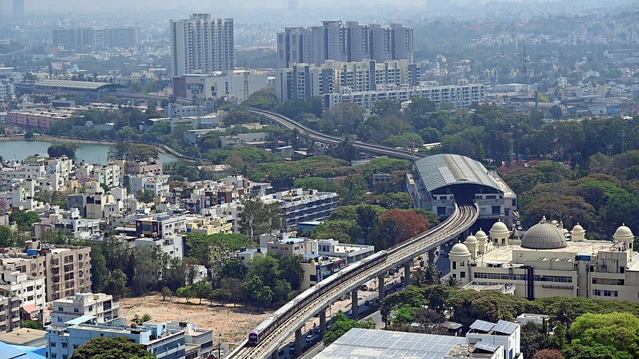
In Mumbai, vulnerable areas include reclaimed, unconsolidated land in Dharavi, Thane and Wadala. In Kolkata, subsidence in Howrah, Tollygunge and Bidhannagar is linked to aquifer withdrawal compacting clay-rich flood plains. Bengaluru, which sits on hard rock, has localised subsidence in Hebbal, Whitefield and Madiwala, primarily due to construction and groundwater extraction from borewells.
Scientists use the term "angular distortion" to refer to the ratio of differential subsidence to the horizontal distance over which it occurs. Higher angular distortion increases the risk of damage to infrastructure and buildings. These studies reveal that some buildings in Chennai and Mumbai are within the risk zone, while buildings in Kolkata and Bengaluru are less threatened due to relatively low angular distortion.
Alluvial deposits from the Holocene epoch, which have historically supported human settlements due to their water and fertile soil, are particularly prone to subsidence from water extraction. Furthermore, increasing global energy demand and the consequent surge in fossil fuel extraction can intensify land subsidence in certain regions.
Thus, groundwater overuse, the weight of urban infrastructure, erratic monsoons, population growth and weak regulations are key factors affecting stability. Nearly 150 cities worldwide, such as Jakarta and Mexico City, face this hazard.
Coastal cities like Mumbai and Chennai face a double threat: subsidence and sea-level rise. Authorities must take note. Policy interventions to reduce groundwater extraction, improve surface water management and groundwater recharge, properly regulate mining, and promote afforestation and soil conservation are key to checking the hazard. The compounding risk of infrastructure damage requires policymakers to develop resilience plans and adaptation strategies that prioritise mitigation and maintenance.
(The author is a retired IFS official and a science/environment communicator)