Calling to be explored


While trekking on the Hallimala-Tharemara hills by the Ramanagara-Magadi Highway, I observed another cluster of hills on the other side of River Arkavathi. Curiosity made me cross the small Ram-Setu bridge. I noticed the entrance of an old fort with broken walls. As it was getting dark, I decided to dig into the history of this old fort and come back.
I was able to lay my hands on Francis Buchanan’s ‘A Journey from Madras through the Countries of Mysore, Canara and Malabar’ (1807), Edward Thornton’s ‘A gazetteer of the territories under the government of the East India Company and of the native states on the continent of India’ (1854), apart from Mysore Archaeological Department reports (1903-13) which talk about Ramagiri.
The whole region surrounding the present Ramadevara Betta, Saptarishi hills, the vulture sanctuary and parts of Ramanagara town and its surrounding villages, were earlier known as Ramagiri. This was recorded by Buchanan, Thornton and others. It was a town with a fort and also the headquarters of Ramagiri taluk.
Tipu Sultan moved the people and township from the west side of River Arkavathi and relocated them to a location at the base of the hill upon which the fort was built. It was a good location to act as a defence, as the jungles and regions within and outside the fort were full of tigers and other wild animals.
However, in 1791 AD, it was at this fort that the residing forces of Tipu Sultan surrendered without any resistance to the army led by Lord Cornwallis. After the treaty, Tipu dismantled the fort and the Amildar (local chief) moved the town back to the west side of the river.
Present state
Entering from the Ram-Setu side, through the gate with a beautiful crown, I saw carvings of deities and other patterns on the pillars of the mantapa at the entrance. There were some inscriptions on the pillars, etched in English, Kannada and Urdu. The English ones detailed the donation of the land to “public charity to feed people” in 1932.
Next to this gate is a small watchtower on a boulder. It rests amid some bushes and the ruins of the fort walls on either side. Close to the Zalzale Shah Baba dargah and Hanuman temple, there is another huge bastion on a small hill. Thereafter, there are only jungles and massive boulders. Amidst these, I found a cave with animal droppings.
Moving upwards through mango orchards, I saw an enclosure on a rocky surface which has a Rama Paada. I also observed another small temple called Hanuman Paada Gudi with a paada (foot) and two stone idols.
Turning towards the left, I climbed one hill and sighted some ruins on the adjoining hill. I took a circuitous route through a valley and the jungles. On this plateau were many broken pieces of old pottery, apart from the ruined foundations of some rooms. Could this be the place described as ‘Karkhane Bande’ in Mysore Archaeological Survey (1909-10), where arsenals, guns and gun powders were being manufactured during Kempe Gowda’s time? Climbing up through the second gate, I found the Kote Anjaneya Swamy Gudi, around which there are several caves.
Main temple
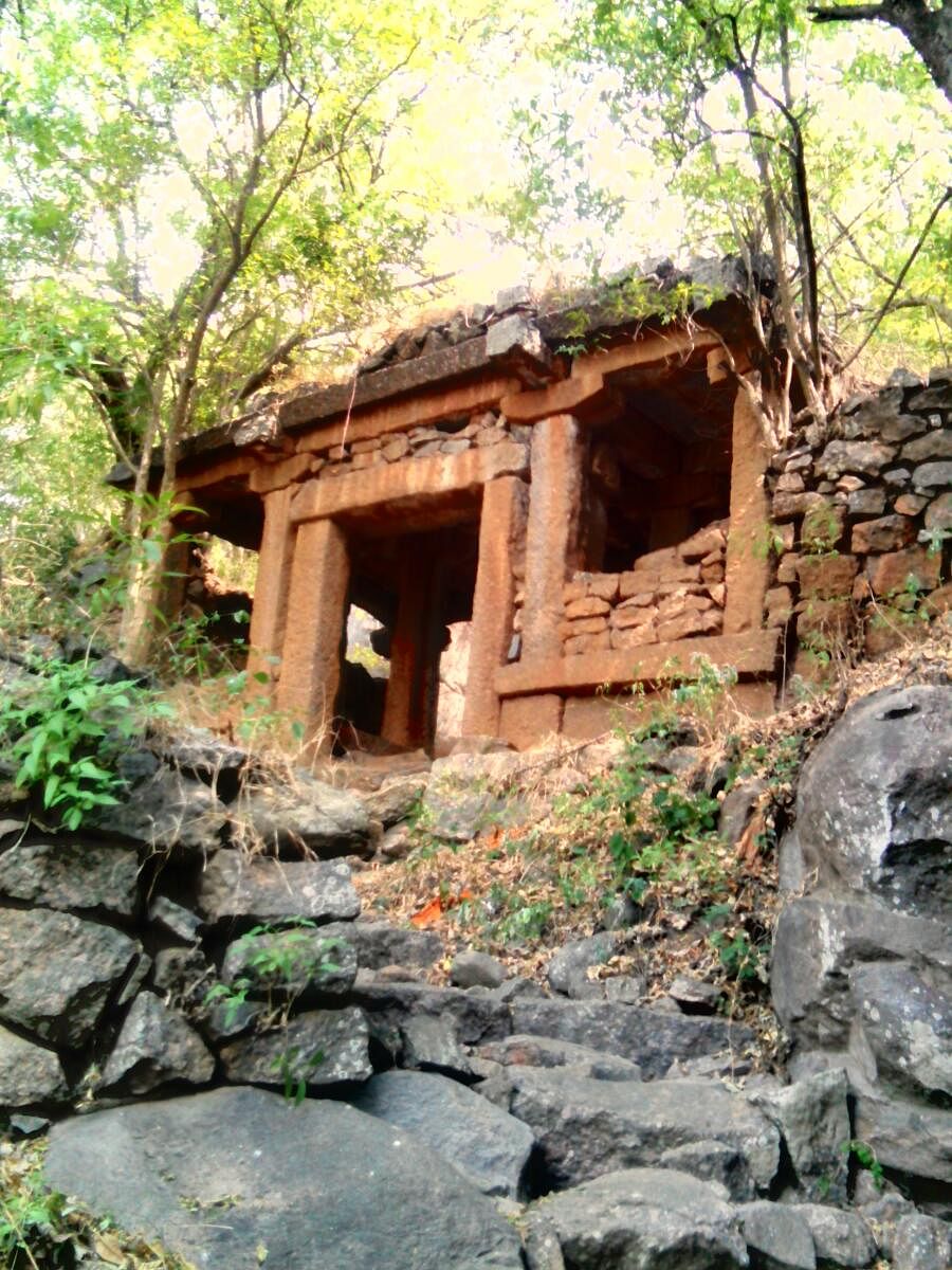
Further up, the main Pattabhirama temple is presumed to be built by Sugreeva from the Ramayana. The ruins of the fort walls can be seen on one side, with the Saptharishi hills and caves on the other side. A unique carving on a boulder depicts Krishna with four hands, two holding the flute and others holding a sudarshan chakra and a shankha, flanked by Garuda and Hanuman. The Ranga Mantapa of the main temple is supposedly built by Kempe Gowda.
On the right side of the main temple is the Rama Teertha (a sacred pond), adjacent to which lies the Rameshwara Swamy Gudi on a small rock. It is said to be built by Rama after he killed a demon Sukraasura (represented by the Handi Gundi Betta).
I climbed up to the summit from the left side of the main temple and saw the outlines of the fort too. The panoramic view of the surrounding jungles and hills in the horizon is mesmerising, though the last stretch of the climb is scary, with caves beneath it.
While coming down, I observed many small temples and caves on either side of the path used by all for visiting the main temples. The present entrance of Ramadevara Betta has fort walls painted with red and white stripes. The stepped route for the summit starts from this point, while the old trek path starts from the Forest Department’s checkpost. Travelling back by the evening passenger train, the silhouettes of various other hills in this region were calling to be explored.
Deccan Herald is on WhatsApp Channels| Join now for Breaking News & Editor's Picks